
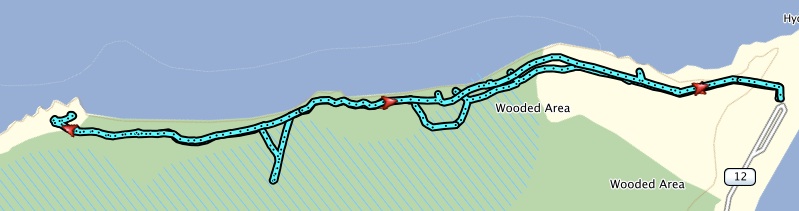
While visiting family in Prince Edward Island, I decided to escape the house and drive up to the most western tip of the island to North Cape and walk 6km along the Black Marsh trail.
The trail is within the North Cape Experimental Wind Farm & interpretation Centre. The trail offers a coastal and forest view, it’s best to walk this clockwise. There are about 21 interpretive signs along the way. These signs are a good reminder of the varied ecosystems that happen to be in this area and of the fishing culture.
Sections of the trail appear not as well maintained or really not as used since you can easily drive the coastal section which is car accessible. We did come across a section of boardwalk which went a long way. A portion was washed out due to erosion.
Once you reach the end of the trail, you will see what’s left of Elephant Rock. This was a popular destination until 1991 where the rock formation crumbled due to the winds and temperature fluctuations. The rock had a portion that actually looked like an elephant. Google search it to see the pictures.
Overall this is an easy trail with plenty of views to enjoy on a nice day. Plenty of ways to get to the ocean floor, look for them and be weary of the eroding cliffs.
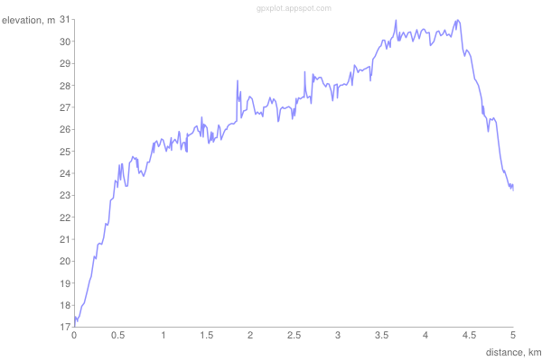
Elevation Profile
Trip Summary: Black Marsh Trail
Trip Stats
Elevation Profile
Terrain & Pace Summary
Minimal elevation change (46 m total gain, 9 m/km) makes this an easy, fast cruise from start to finish.
Tight trails, obstacles, or frequent stops kept speeds low — come prepared.
Stops Along the Way
- 16 minMap it
Stops detected where GPS movement paused for 5 minutes or more — likely a viewpoint, snack break, or photo opportunity.
Points of Interest near Start / End
Trail Access & Pass Information
- Check your provincial / state OHV registration requirements before riding.
- Verify gate and seasonal-closure status with a local ATV club or land manager.
- Some trail networks require a separate trail pass — confirm with the local OHV association.