
Estimated reading time: 5 minutes
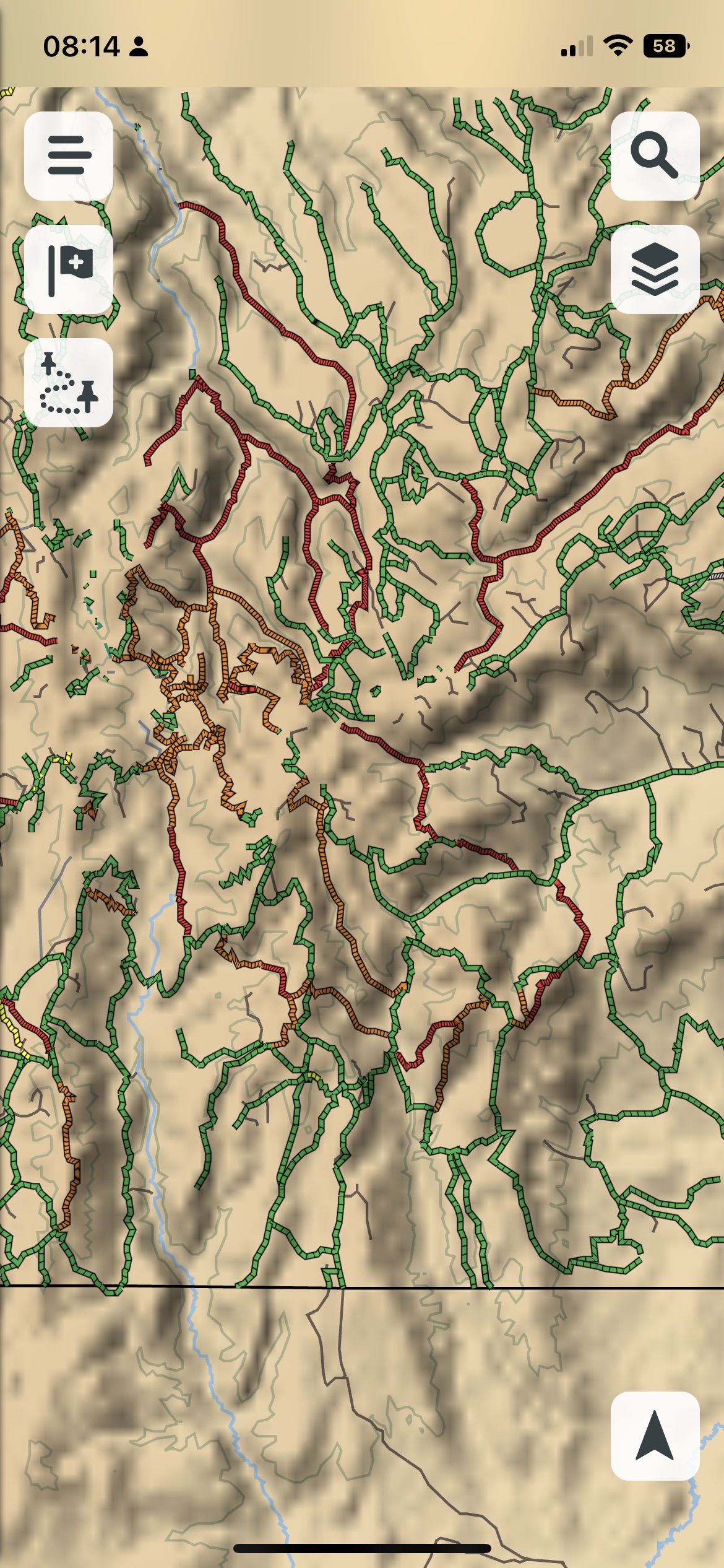
The Garmin Tread Off-Road GPS Device displays a lot of trail information curated from various sources like OpenStreetMap and MUVM for many areas of the US. This specific type of information allows you to find out trail access and difficulty whether you want to hit the trails in a full sized vehicle, ATV, Side by Side or snowmobile.
Users in Canada can also see some of this trail information but it does not match what you can find in US public lands. However, we’ll take a look at the latest features to determine Trail access and Difficulty on your Garmin Tread.
How To Enable Adventure Roads and Trails
“Adventure Roads & Trails” is a map layer that is available either on your Garmin Tread GPS device or Garmin Tread smartphone app. Just select the map layer icon and select the layer.

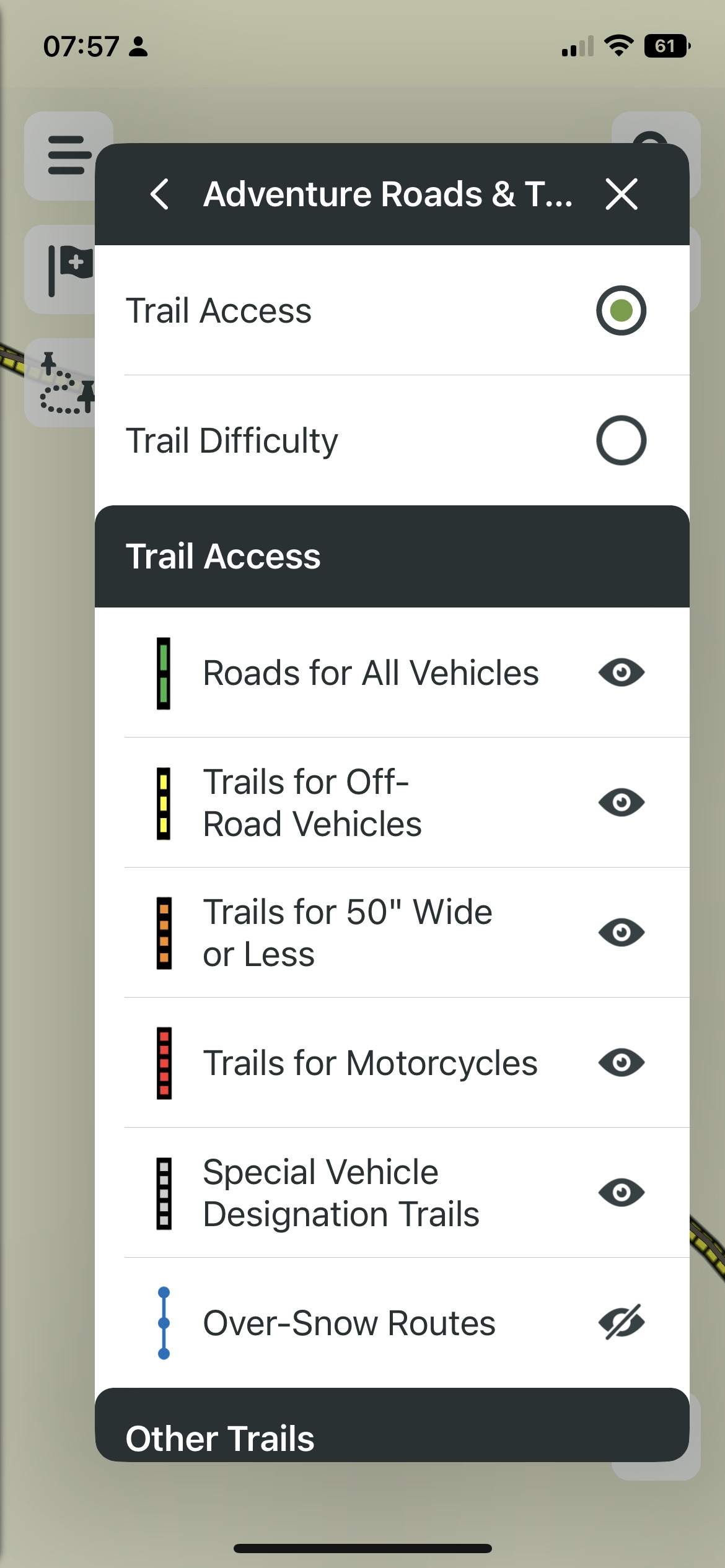
How To View Trail Access
Lets say you want to plan a route but not sure how wide the trail is a route during snow season. We just need to flip to the Trail Access settings and we will see based on color roads & trails that we can access based on our vehicle. The color legend helps:
- Road for all vehicles (Green)
- off-road vehicles (Yellow)
- trails for 50 inches wide or less
- trails for motorcycles
- special designation trails (grey)
- over-snow route (dotted blue)
- unpaved roads
- foot trails
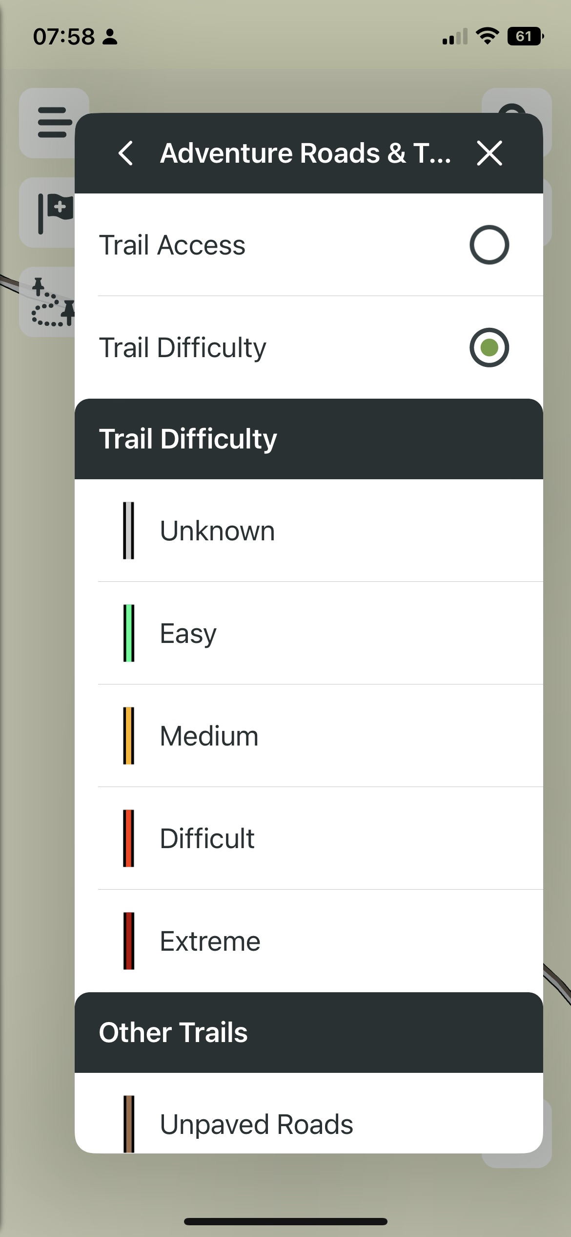
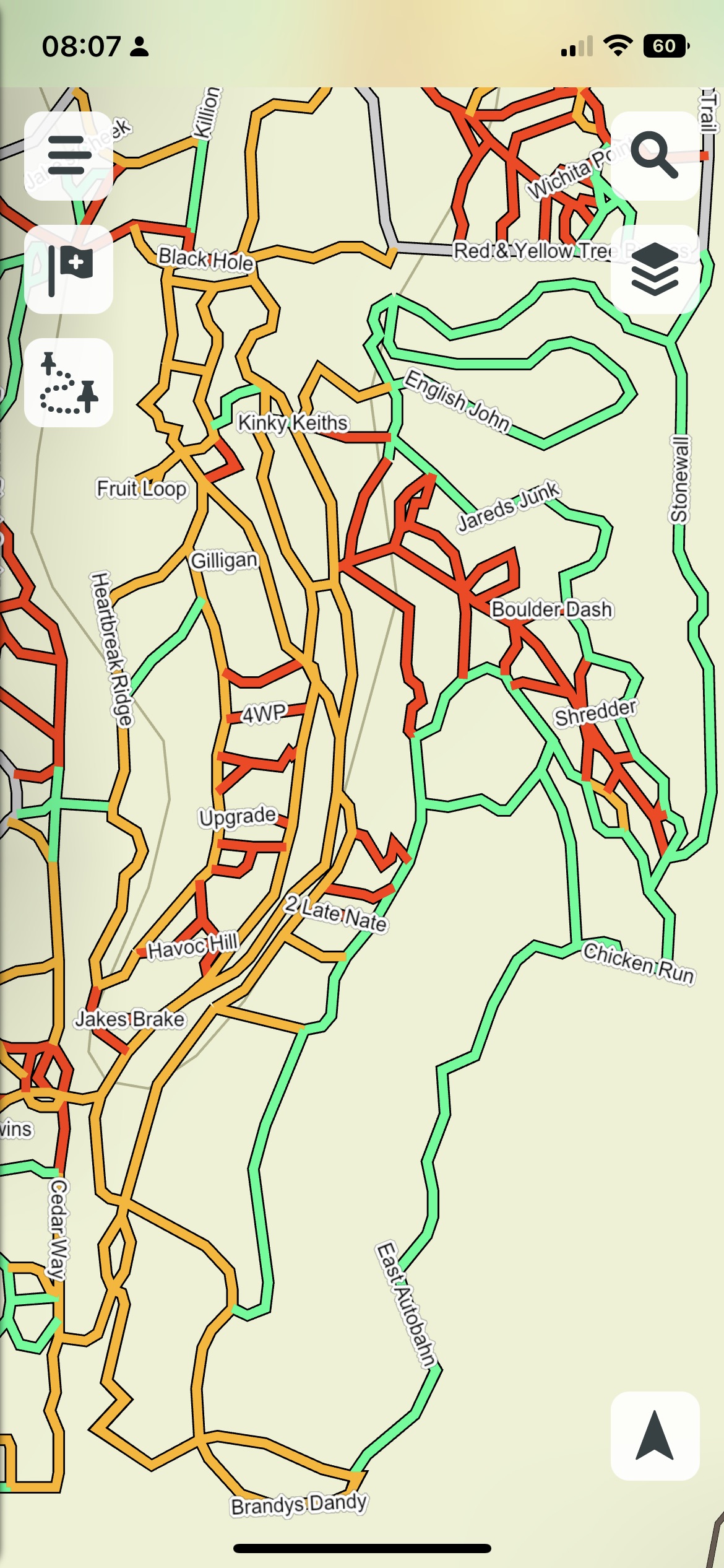
How To View Trail Difficulty
Once you found your trail, you may want to see the difficulty. Just go back to the map layer and from the Adventure Roads and Trails section, toggle to Trail Difficulty. Again you will see in some cases a color legend:
- unknown (grey) – the most common you might find
- Easy (green)
- Medium
- Difficult
- Extreme
25 More Off-Road Trail Areas
For the release of North America Adventure Roads & Trails 2023.10, Users in the US will be able to get Trail access and difficulty for 25 off-road areas, with potentially more in the future.
Trails and Difficulty Ratings
| NAME | CITY | STATE | TRAIL DIFFICULTY |
|---|---|---|---|
| Adventure Off Road Park | South Pittsburg | TN | Y |
| Alligator Run | Tatum | TX | N |
| Badlands Off Road Park | Attica | IN | N |
| Black Mountain Off-road Adventure Area | Evarts | KY | Y |
| Blue Holler Off-road Park | Mammoth Cave | KY | Y |
| Chaos Off-road Park | Capon Bridge | WV | N |
| Cross Bar Ranch Off Road Park | Davis | OK | Y |
| Dirty Turtle Off-road Park | Bedford | KY | Y |
| Flat Nasty Off-road Park | Jadwin | MO | Y |
| General Sam’s ATV and Off-road Park | Huntsville | TX | N |
| Hidden Falls Adventure Park | Marble Falls | TX | Y |
| Hollerwood | Stanton | KY | Y |
| Kansas Rocks Recreational Park | Mapleton | KS | Y |
| Moonlight Off-road | Sullivan | MO | Y |
| Pickett State Forest (Blackhouse) | Jamestown | TN | N |
| Rausch Creek Off Road Park | Pine Grove | PA | Y |
| Ride Royal Blue | Pioneer | TN | Y |
| Rush Springs Ranch | Pineville | MO | Y |
| Southern Missouri Off Road Ranch (SMORR) | Seymour | MO | Y |
| The Swamp Off-road Park | Chipley | FL | N |
| Twisted Trails Off-road Park | Copemish | MI | Y |
| Vandyz Off-road Park | Steedman | MO | N |
| Wildcat Adventures | East Bernstadt | KY | N |
| WindRock Park | Oliver Springs | TN | Y |
| Wolf Caves | Mason | TX | Y |
How Does This Compare To Gaia GPS Overland Maps?
Much like the GaiaGPS Overland map layer, this caters mainly to US off-road users is specific areas where the added features can be taken advantage of. The benefit of Garmin mapping specific off-road areas will be something to build upon for trail riding while Gaia GPS Overland map adds in more planning elements like camping.
Users riding in Canada will expect to not see much of these features as the trail access information is sparse in many areas due to the map information. It is usable, but you won’t get as much out of it as if you were in the US.