
Last updated: August 1, 2026. Trail access, park facilities, overnight options and local rules can change. Check the current park, municipality or trail manager before relying on older directions.
From the Nova Scotia Hiking Trail Guide
- Guide category: Panorama Trails
- Length: 16 km (return)
- Difficulty: 2C
- Duration: 6 hours
- Book trailhead: N45 18.877 W64 25.743
 Pets on leash / Dog friendly
 Stay on trail
 Trailhead
 Parking
One of the must-do hiking trail in Nova Scotia .
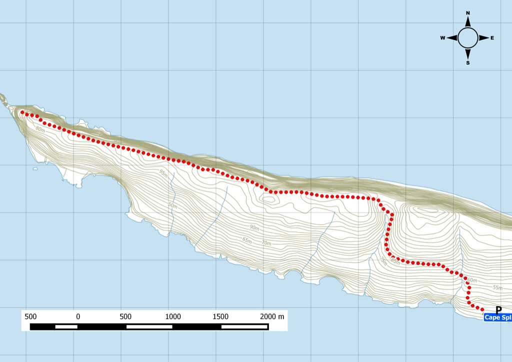
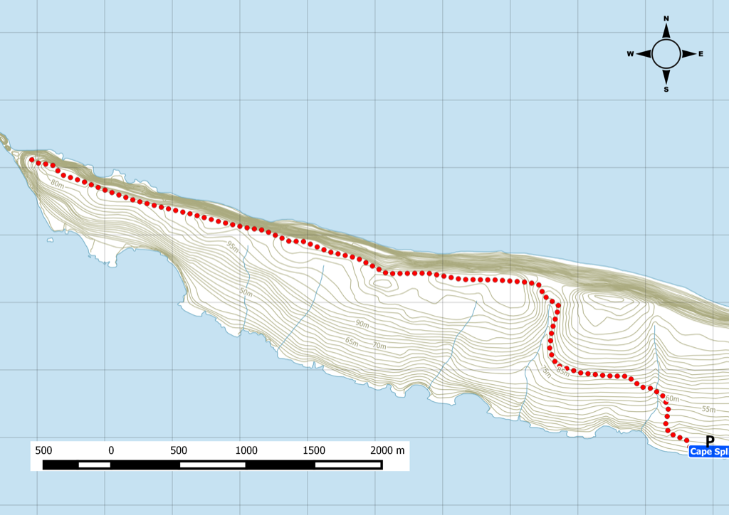
Nestled within the 428-hectare Cape Split Provincial park reserve, Cape Split is one of the most prominent hikes in Nova Scotia. The Department of Natural Resources recently acquired parcels of this land to implement a long term management plan for more than 20 kms of trails and basic facilities such as a parking lot. The trail is a slow climb that begins on an old logging road. Along the cliff, the trail becomes a well-established footpath. The terminus of the trail provides the inspiring panoramic view of the Minas Basin.
Trip Summary
Trip Stats
Elevation Profile
Terrain & Pace Summary
Good rolling terrain with 495 m of gain over 13.6 km (36 m/km). Rewarding underfoot without being punishing.
Easy 3.2 km/h pace — plenty of time to take in the surroundings.
Stops Along the Way
Stops detected where GPS movement paused for 5 minutes or more — likely a viewpoint, snack break, or photo opportunity.
Trails Near This Route
Nearby Trails
Trail Access & Pass Information
- Check your provincial / state OHV registration requirements before riding.
- Verify gate and seasonal-closure status with a local ATV club or land manager.
- Some trail networks require a separate trail pass — confirm with the local OHV association.
Trail Photos
What About The Spring?
The hike to Cape Split Nova Scotia is one on the most beautiful day hikes in the province. This was the first time I went is the spring and the flowers were spectacular. This Provincial Park Reserve juts its rugged cliffs into the Bay of Fundy and is accessible year-roundRecent Trail Notes
Recent trail-related items found during a five-year news and organization scan. Conditions and access can change quickly, so verify details with the park, trail manager, or local association before heading out.
Cape Split
- 2026-06-01 – Explore Spectacular Cape Split Provincial Park – From Forest Trails to Dramatic Ocean Lookoffs – To Do Canada (To Do Canada)
- 2026-01-30 – Pair stranded in dark on remote beach near Cape Split rescued by helicopter – CBC (CBC)