
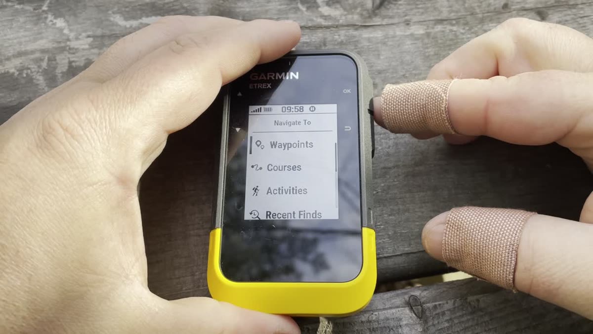
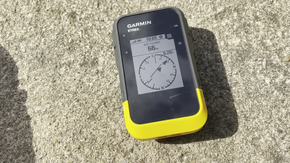
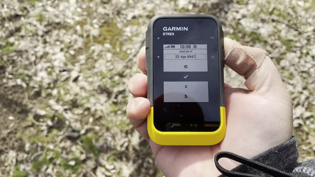
A Garmin handheld GPS is useful because it keeps navigation separate from your phone. In this companion guide, we will use Jim Cyr’s Garmin eTrex SE waypoint video as the practical example: mark a spot, navigate to it, use the compass page, edit the waypoint and stop navigation when you are done.
This beginner guide covers the basic terms and habits that make a Garmin handheld GPS easier to use before a hike, camping trip, backroad drive or ATV ride in Canada.
Last reviewed: September 2, 2026. Garmin device menus, app compatibility and software workflows can change. Check Garmin’s current support pages for your specific model before relying on exact menu names.
What This Guide Covers
This article should help readers who are new to Garmin handheld GPS units understand what they are looking at before they get buried in model numbers, maps and settings. The video uses the Garmin eTrex SE, but the basic ideas carry over to many handheld GPS workflows.
The goal is not to teach every feature. The goal is to get a beginner comfortable with the core ideas:
- where they are
- where they are going
- how to mark a useful location
- how to follow a planned line
- how to get back to a saved point
- how to move GPX data on and off the device
- what to check before leaving home
Start With The Job, Not The Model Number
Garmin makes different handheld devices for different users. A hiker, geocacher, ATV rider, snowmobiler and backcountry traveller may all say they need a GPS, but they may not need the same device.
For a beginner, start with the trip:
- Are you walking a marked trail?
- Are you following an ATV route?
- Are you saving a campsite, truck location or trail junction?
- Are you loading a GPX file from a trail guide?
- Are you travelling somewhere with poor cell service?
- Do you need satellite messaging or SOS, or only navigation?
That last question matters. A standard handheld GPS can help with navigation, but it is not the same thing as a satellite communicator. If you need two-way messaging or SOS outside cell service, look at an inReach device or another satellite communicator.
The Five GPS Terms Beginners Should Know
Most confusion starts with a few words that sound similar but do different jobs.
Waypoints
A waypoint is a saved location. It can be a parking area, trailhead, campsite, viewpoint, junction, geocache, fuel stop or anything else worth saving.
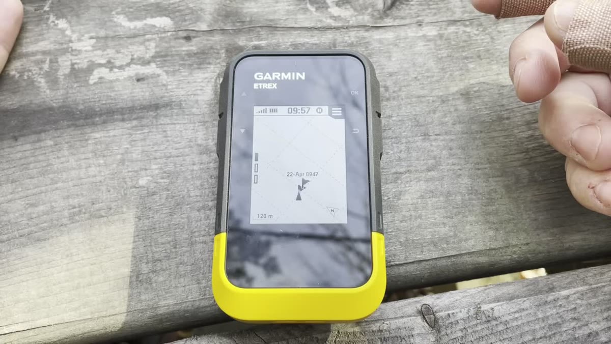
For outdoor use, waypoints are one of the simplest and most useful GPS features. Before a hike, you might save the trailhead and a few key junctions. During a trip, you might mark where you parked, where you turned around, or where you found a campsite worth returning to.
For ATV riding, waypoints can be useful for staging areas, gates, intersections, fuel, washouts and meeting spots.
Tracks
A track is a line showing where someone travelled. Your Garmin can record your own movement, and you can often load a track created by someone else.
Tracks are useful because they show a path without assuming the GPS can calculate every road, trail or junction correctly. For hiking and ATV travel, that can be more reliable than asking the device to invent a route in areas where trail data is incomplete.
Routes
A route is a planned sequence of points that leads to a destination. Garmin’s own GPSMAP 67 manual describes a route as a sequence of waypoints or locations that leads you to your destination.
Routes can work well when the map data supports routing. They can be less helpful when a trail, woods road or ATV route is missing, gated, seasonal or not routable in the map data.
Courses
Garmin’s newer ecosystem also uses courses. Garmin describes courses as having multiple destinations and being able to follow a direct path or routable roads/trails depending on the device and settings.
For a beginner, the practical point is this: do not panic if Garmin Explore, a watch, a handheld or BaseCamp uses slightly different terms. Check what your specific device supports and test the file before the trip.
GPX Files
GPX is a common file format used to move outdoor GPS data between apps, websites and devices. Garmin support says GPX files can contain routes, tracks, waypoints and geocaches.
If you download a trail file from a guide, event organizer or mapping site, there is a good chance it may be a GPX file.
What A Beginner Should Learn First
Do these before worrying about advanced settings.
- Turn the GPS on and wait for it to find satellites.
- Open the map page and watch your position update.
- Save your current location as a waypoint.
- Rename that waypoint to something useful.
- Start track recording.
- Walk or drive a short loop.
- Stop and save the track.
- Use the device to navigate back to the saved waypoint.
- Connect the GPS to a computer and look at the saved data.
- Load one test GPX file and confirm it appears on the device.
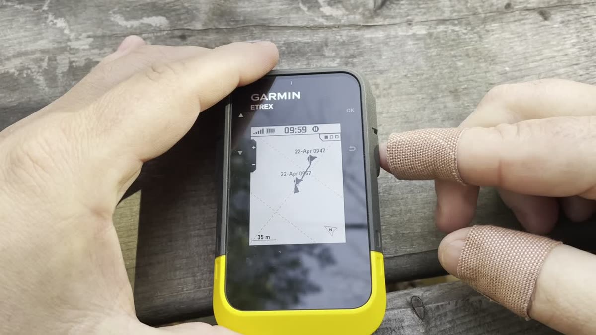
That short practice session solves most beginner problems because it teaches the difference between live position, saved points and recorded travel.
Set Up The GPS Before Leaving Home
Do not make your first real setup session happen at the trailhead.
Before a trip:
- Charge the GPS or install fresh batteries, depending on the model.
- Check the date, time, units and position format.
- Confirm the map you need is installed and enabled.
- Load GPX tracks, routes or waypoints at home.
- Rename important saved locations so they are easy to understand.
- Check that the device can actually see the items you loaded.
- Clear old clutter if the map screen is too busy.
- Pack the right cable, spare batteries or power bank.
- Bring a paper map or offline phone map where the trip justifies it.
For Canadian trips, assume there may be gaps in cell coverage even near communities. A GPS should be ready before the phone loses service.
Garmin Explore, BaseCamp Or Direct File Copy?
There are several ways to manage Garmin GPS data. The right one depends on your device and how comfortable you are with files.
Garmin Explore
Garmin Explore is Garmin’s newer trip-planning and data-management ecosystem for compatible devices. Garmin says the Explore app and website can be used to create and manage routes, waypoints and collections, and to sync data with compatible Garmin devices.
Garmin support also notes that navigation in the Garmin Explore app requires a connected Garmin device when using a course, route or track for navigation.
Use Garmin Explore when:
- your device is compatible
- you want a phone-based workflow
- you use collections to organize trips
- you want easier syncing between the app, website and device
Garmin BaseCamp
Garmin BaseCamp is older desktop software, but it is still useful for many handheld workflows. Garmin describes BaseCamp as software for planning outdoor activities, organizing data, viewing maps, creating routes and waypoints, and transferring data to a device.
Garmin support says GPX files can be imported into BaseCamp and transferred to compatible outdoor handhelds.
Use BaseCamp when:
- you prefer a computer screen
- you work with multiple GPX files
- you want to organize tracks, waypoints and routes before copying them to a handheld
- your older Garmin device fits that workflow better than Garmin Explore
Direct File Transfer
Some users copy GPX files directly to the Garmin device storage when it appears on a computer. This can work on many models, but beginners should be careful. Folder names and supported data types vary by device.
If you use direct file transfer, test it with one GPX file before a real trip. Confirm the track, route or waypoint appears on the GPS menu, not just on the computer.
Map Basics
A GPS without the right map can still give you coordinates, save waypoints and record tracks, but the map screen may not show the detail you expect.
Before a trip, check:
- Is the correct map enabled?
- Does the map show roads, trails, contours or water features you care about?
- Is the map routable, or is it mostly visual reference?
- Does the route or track line appear clearly over the map?
- Are you zoomed in far enough to see trail detail?
For hiking, topographic detail can matter. For ATV riding, road and trail access matters. For backroad travel, you may care more about forest roads, water crossings, gates and fuel stops.
No map is a guarantee of current trail access. Seasonal closures, private land, storm damage, washouts and local rules still need to be checked from current sources.
Beginner Field Routine
At the start of a hike or ride:
- Turn the GPS on before leaving the vehicle.
- Wait for a solid position fix.
- Mark the parking spot or staging area.
- Start track recording.
- Confirm the loaded track or route is visible.
- Check battery level.
- Put the GPS where it can be reached and seen.
During the trip:
- Glance at the GPS at junctions, not only after you are unsure.
- Zoom in when trail detail matters.
- Add waypoints for useful discoveries or hazards.
- Watch for the difference between your recorded track and the planned line.
- Do not follow a GPS line through unsafe terrain just because the screen says it continues.
At the end:
- Stop and save the track.
- Rename it while you still remember the trip.
- Sync or back it up before deleting anything.
Common Beginner Mistakes
| Mistake | Why It Causes Problems | What To Do Instead |
|---|---|---|
| Loading a GPX file but never checking it on the device | The file may be in the wrong place or unsupported format | Open the track, route or waypoint list before the trip |
| Forgetting to mark the vehicle location | It removes the easiest backtrack reference | Mark the parking spot before leaving |
| Assuming routes and tracks are the same | Routes may recalculate; tracks show a travelled line | Use tracks when following a known trail line |
| Leaving old data visible | Too many lines and points make the map hard to read | Clean up or hide old trip data |
| Depending only on one device | Batteries, screens and files can fail | Carry backup navigation for higher-risk trips |
| Trusting old trail data | Access can change | Verify current access before relying on a route |
What I Would Teach A Beginner First
If someone handed me a Garmin handheld GPS and wanted the shortest useful lesson, I would skip most menus at first.
I would teach:
- how to find the map page
- how to mark the current location
- how to start and stop track recording
- how to follow a loaded track
- how to zoom in and out
- how to navigate back to a saved waypoint
- how to check battery level
Once those are comfortable, then it makes sense to move into GPX files, Garmin Explore, BaseCamp, map installs, profiles and more advanced navigation settings.
Related Avoiding Chores Guides
- How To Prepare Your GPS For A Hike
- Garmin Maps: Paid vs Free
- Garmin inReach Mini 3 Setup Guide For Canadian Hikers
- How To Prepare Satellite Communicator Contacts Before A Trip
- What To Pack For A Remote ATV Ride In Atlantic Canada
Current References
- Garmin Support: Navigating a Course, Route, or Track in the Garmin Explore App
- Garmin Support: Importing GPX Files into BaseCamp and Transferring the Data to a Garmin Outdoor Handheld
- Garmin Explore: Welcome to Explore
- Garmin GPSMAP 67 Owner’s Manual: Navigation
- Garmin: BaseCamp Software
- Time-sensitive details: app compatibility, menu names and supported transfer methods should be checked against the specific Garmin device before publication.