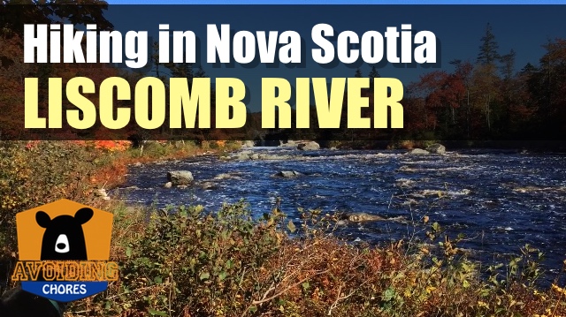
We opted to hike to the main money shot of the trail, the suspension bridge and turn back. It still ended up being a 8km hike, but my fur buddy didn’t like crossing the bridge. So starting out from the main parking lot, we hiked behind the cabins onto the trail following the river. the trail is well defined and groomed as we approached the scenic views of crooked falls and the lookout.
Past that point, the trail often looks like a goat path and with the terrain suddenly increasing in difficulty. We crossed a stream via a small footbridge and continued along the river. There are several pools that allow salmon to spawn up river. It was until the halfway point that we saw the fish ladder on one side and the bridge on the other.Keji the #blacklab enjoyed his #hike today at Liscomb Lodge. #dogsofinstagram #labsofinstagram #getoutside #tioutsiders #VisitNovaScotia A photo posted by Jim Cyr (@thecyr) on
By climbing up to the bridge, we saw the gorge and the fantastic view looking down river. We could have continued the loop, but as expected my fur buddy didn’t want to cross the bridge. That’s ok, we’ll be back.
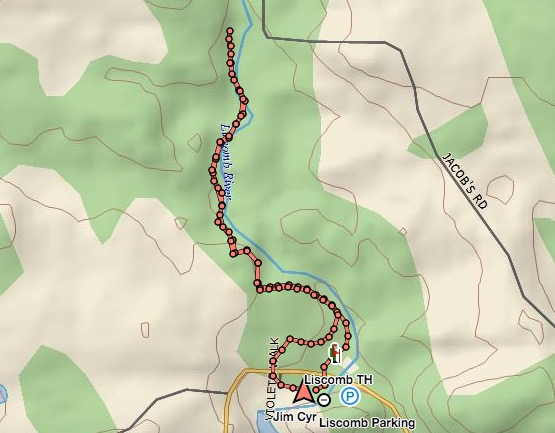
Trip Summary: Liscomb River Trail
Trip Stats
7.2km
Distance
4.5mi
Distance
3h 03m
Total time
2.4km/h
Avg speed (incl. stops)
2.5km/h
Moving speed
263m
Elevation gain
264m
Elevation loss
61m
Highest point
Elevation Profile
Terrain & Pace Summary
Hilly / Technical
This route packs 263 m of climbing over 7.2 km (36 m/km) — expect frequent ups and downs and sections that demand attention.
Technical / Slow-going
Tight trails, obstacles, or frequent stops kept speeds low — come prepared.
Points of Interest near Start / End
⚠️ The businesses below were identified from public mapping data at the time of generation.
Always verify hours and ATV-friendliness before you ride.
Accommodation
Airbnb near trailhead
Search Airbnb for rural properties that welcome trailers.
View on Maps / WebTrail Access & Pass Information
⚠️ Trail pass and gate information changes seasonally.
The notes below are based on publicly available information at time of generation — verify before you go.
- Check your provincial / state OHV registration requirements before riding.
- Verify gate and seasonal-closure status with a local ATV club or land manager.
- Some trail networks require a separate trail pass — confirm with the local OHV association.
Trip Summary: Liscomb River- Mayflower Trail
Trip Stats
2.4km
Distance
1.5mi
Distance
1h 13m
Total time
2.0km/h
Avg speed (incl. stops)
2.0km/h
Moving speed
241m
Elevation gain
257m
Elevation loss
61m
Highest point
Elevation Profile
Terrain & Pace Summary
Hilly / Technical
This route packs 241 m of climbing over 2.4 km (100 m/km) — expect frequent ups and downs and sections that demand attention.
Technical / Slow-going
Tight trails, obstacles, or frequent stops kept speeds low — come prepared.
Waypoints & Stops
- firepit (45.00661, -62.09443)
- junction1 (45.01218, -62.09563)
- Mayflower trail map (45.00973, -62.09497)
- Mayflower trailhead (45.01240, -62.09555)
- trail map (45.00930, -62.09963)
- trail map 2 (45.00690, -62.09420)
- trail map 21 (45.01163, -62.09909)
Points of Interest near Start / End
⚠️ The businesses below were identified from public mapping data at the time of generation.
Always verify hours and ATV-friendliness before you ride.
Accommodation
Airbnb near trailhead
Search Airbnb for rural properties that welcome trailers.
View on Maps / WebTrail Access & Pass Information
⚠️ Trail pass and gate information changes seasonally.
The notes below are based on publicly available information at time of generation — verify before you go.
- Check your provincial / state OHV registration requirements before riding.
- Verify gate and seasonal-closure status with a local ATV club or land manager.
- Some trail networks require a separate trail pass — confirm with the local OHV association.
Original Photos