Last updated: July 26, 2026. Check current local access, tides, weather and any posted restrictions before visiting Partridge Island.
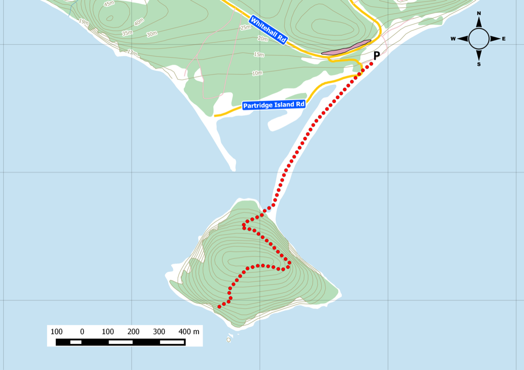
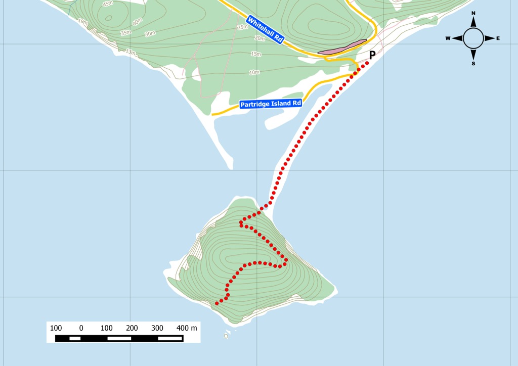
Partridge Island remains a short but worthwhile Parrsboro-area hike and lookout stop. The preserved map and media below keep Jim’s original route context and newer trip-summary content intact.
Current Planning Notes
- Nova Scotia Nature Trust identifies Partridge Island as a protected coastal site.
- Stay on established paths, avoid disturbing sensitive areas and respect posted guidance.
- Use tide, weather and road-condition checks when combining this with other Bay of Fundy stops.
Related Avoiding Chores Links
- Cape d’Or Lighthouse And Coastal Park
- Hiking Burntcoat Head Park In Nova Scotia
- Nova Scotia Hiking Trail Guide
- Garmin Maps: Paid vs Free
- Garmin inReach Messenger How-To Tutorials
- ZOLEO Satellite Communicator Overview
Current References
- Nova Scotia Nature Trust: Partridge Island
- Tourism Nova Scotia: Partridge Island Lookoff and Hiking Trail
From the Nova Scotia Hiking Trail Guide
- Guide category: Summit Trails
- Length: 3.3 km (return)
- Difficulty: 4C
- Duration: 2 hours
- Book trailhead: N45 22.454 W64 19.775
 Parking
 Stay on trail
 Trailhead
A short steep climb with excellent views of Blomidon and Cape Split.
A quick hike from Ottawa H ous e Museum, across the beach, to the trailhead. This is a steep climb with a few resting spots along the way. The money shot at the end is totally worth it. Keep the pets at home or a short leash. You’re climbing along a steep edge. Watch this trail on YouTube.
Trip Summary
Trip Stats
Elevation Profile
Terrain & Pace Summary
A demanding climb with 321 m of elevation gain over 3.3 km (97 m/km). Expect sustained ascent and a real workout.
Easy 2.1 km/h pace — plenty of time to take in the surroundings.
Trails Near This Route
Nearby Trails
Trail Access & Pass Information
- Check your provincial / state OHV registration requirements before riding.
- Verify gate and seasonal-closure status with a local ATV club or land manager.
- Some trail networks require a separate trail pass — confirm with the local OHV association.
Trail Photos