
Last updated: July 26, 2026. The Bluff Wilderness Trail crosses protected wilderness land. Check current trail association notices, wilderness-area rules and conditions before hiking.
From the Nova Scotia Hiking Trail Guide
- Guide category: Trekking
- Length: 8.3 km (return)
- Difficulty: 2D
- Duration: 3 hours
- Book trailhead: N44 39.939 W63 45.771
 Bicycle trail
 Transit access
 Information
 Litter Receptacle
 Parking
 Pets on leash / Dog friendly
 Stay on trail
 Trailhead
 Trail boardwalkViewing area
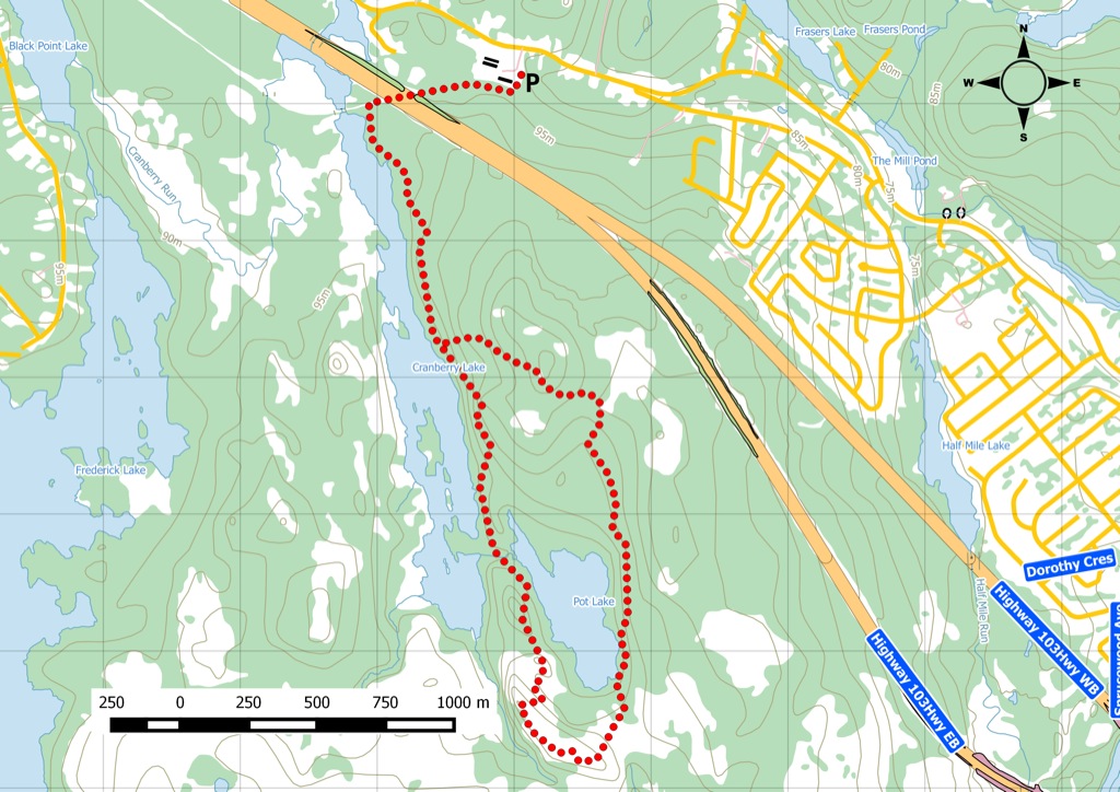
The shortest of four loop trails in this popular wilderness area off of the BLT trail.
Pot Lake loop is the shortest of the four backcountry wilderness hiking loops within Halifax City limits. This is an unsupervised wilderness trail. The terrain is rugged, going over granite and tree roots. Footing is a challenge during wet weather. Trail markers can be found on trees and painted on the granite rocks. Parking and the trailhead are located along Route 3 at Civic #2890 (next to Bay Storage). Transit users can take bus routes 21and 23 to reach the parking area. You start along the BLT trail under the 103 Highway and to the Bluff Wilderness Trailhead. Watch this trail on YouTube.
Trip Summary
Trip Stats
Elevation Profile
Terrain & Pace Summary
Good rolling terrain with 414 m of gain over 8.3 km (50 m/km). Rewarding underfoot without being punishing.
Easy 2.6 km/h pace — plenty of time to take in the surroundings.
Stops Along the Way
Stops detected where GPS movement paused for 5 minutes or more — likely a viewpoint, snack break, or photo opportunity.
Trails Near This Route
Nearby Trails
Trail Access & Pass Information
- Check your provincial / state OHV registration requirements before riding.
- Verify gate and seasonal-closure status with a local ATV club or land manager.
- Some trail networks require a separate trail pass — confirm with the local OHV association.
Trail Photos
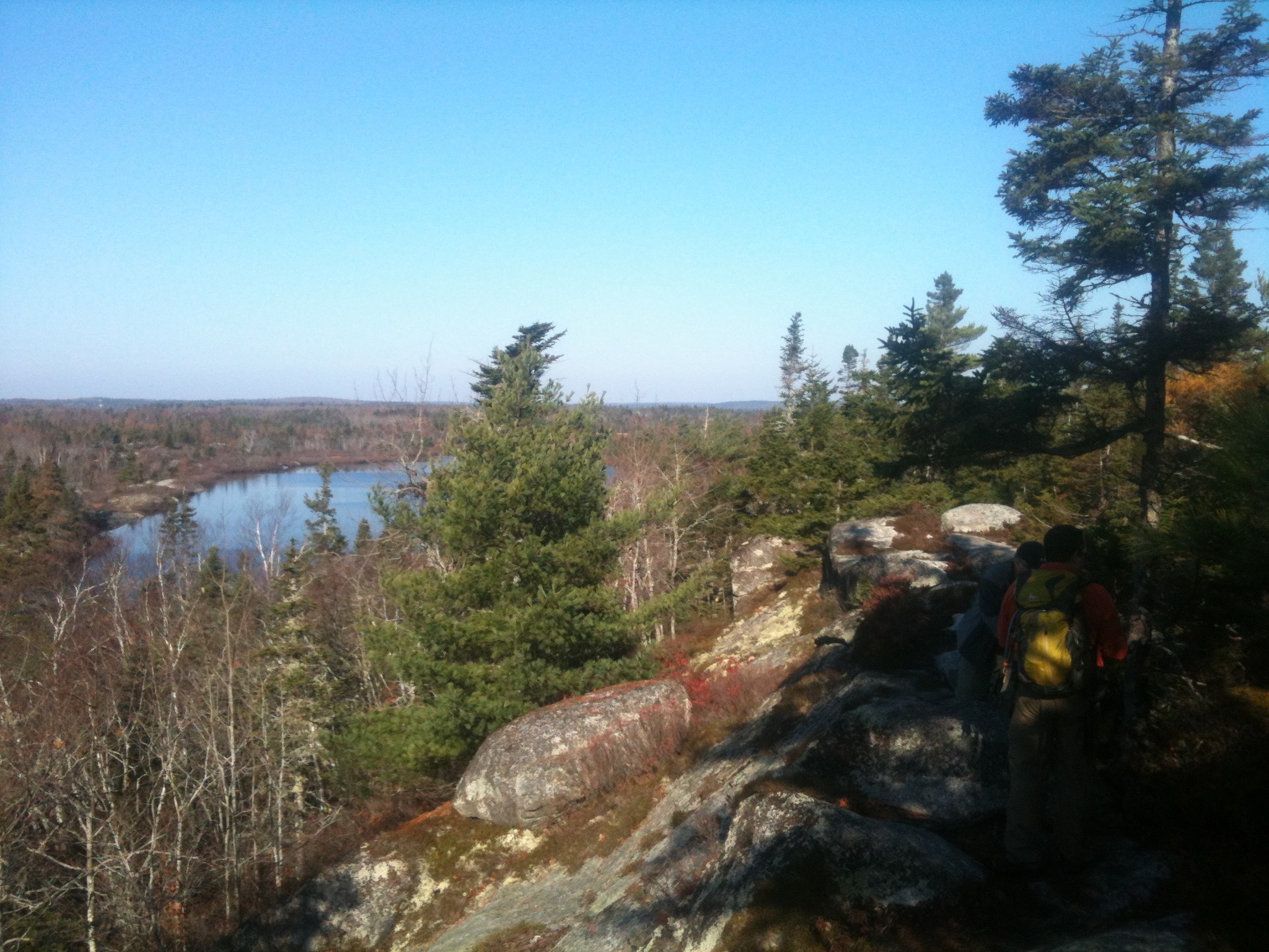
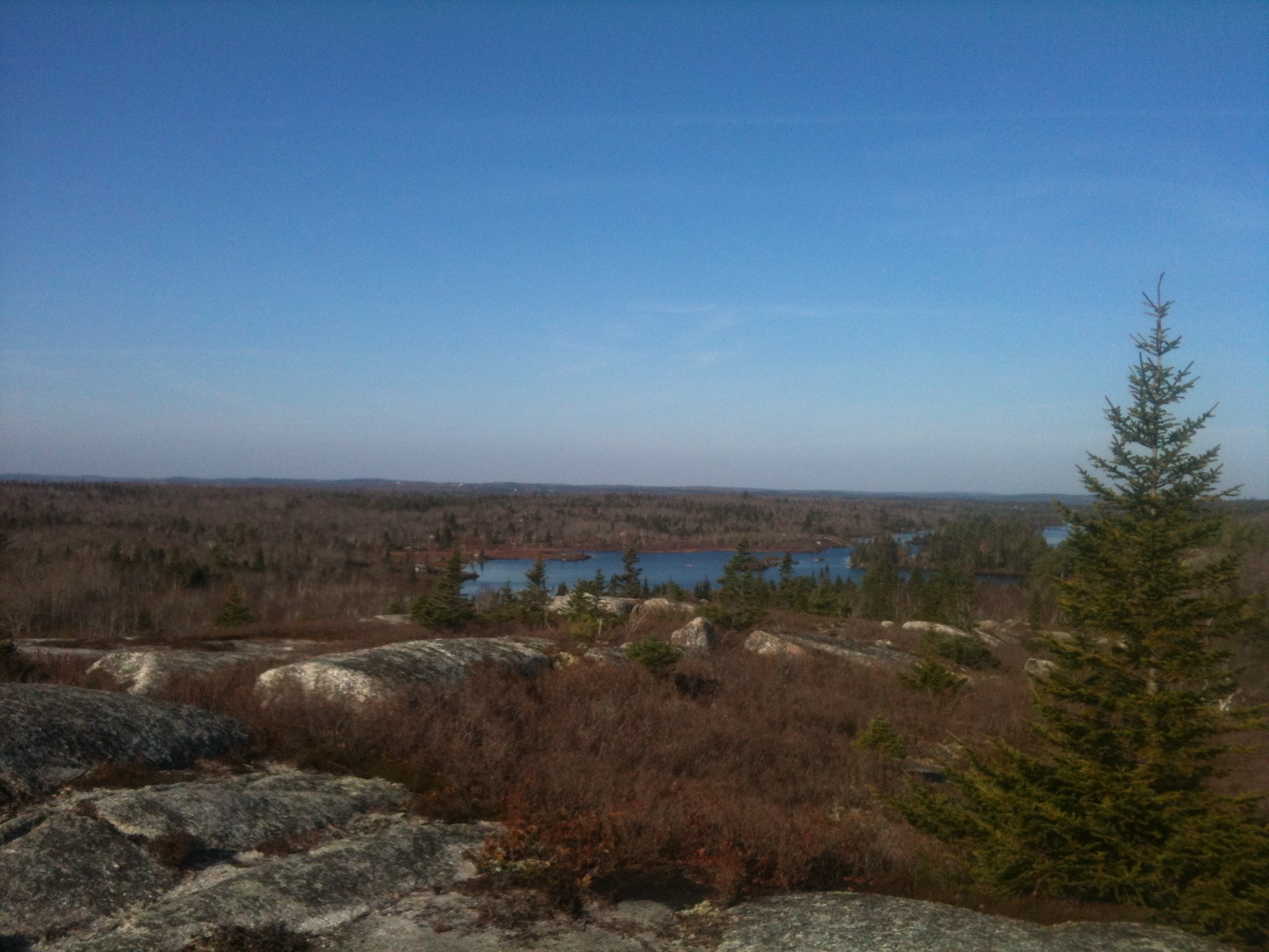
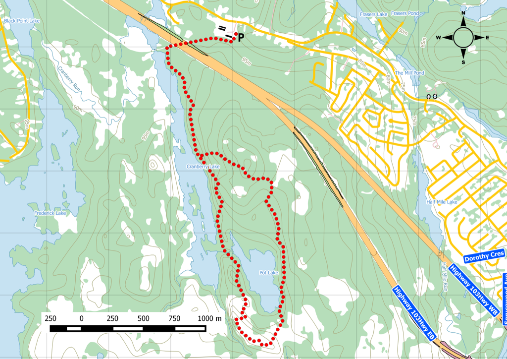
Nice big 8km hike along a wilderness trail, just minutes outside of Halifax. Decided to attempted the smallest hiking loop in the Bluffs, called Pot Lake loop. We parked the car at the closest parking lot and walked about 400m to the actual trailhead. We followed the BLT trail where you can either continue to Hubley or downtown Halifax.
The trail was well marked with colour markers, which was a big improvement from the spray painted arrows that were almost impossible to see. The area is big on Leave no Trace since the trail is along sensitive barrens. Do bring adequate gear and supplies, cell phone coverage is good, but the area is remote and the only way to help in fast is by helicopter.
More about the Bluff Wilderness trail
The The Bluff Wilderness Hiking Trail is located on Crown Land south of Highway 103 where it crosses the Chebucto Peninsula just west of Halifax, Nova Scotia. It begins inside the Woodens River watershed and climbs onto the high ground (“The Bluff” ) between the Woodens River watershed and the Nine Mile River watershed to the east.
The trailhead is located on the Beechville-Lakeside-Timberlea (BLT) trail at a point midway between the Hwy 103 overpass just south of Exit 4 and the northern tip of Cranberry Lake. A parking lot has been constructed specifically for visitors to The Bluff Trail.
Carrying a cell phone is advised and always let someone know your plans and expected time of return. Plan your exursion to leave planty of time to return during daylight hours and cut it short if it’s taking longer than expected. Hikers should be alert since they will be traveling through bear and moose country. There are also coyotes.The trail is a wilderness trail, designed to challenge and delight the experienced hiker. Hikers should use caution at all times.
Deer hunting season runs from the last Friday in October to the first Saturday in December inclusively. Hunting is not permitted on Sundays. Hunter orange is recommended in this period. Please use The Bluff Trail with added caution during this period.
Current References
- Woodens River Watershed Environmental Organization: The Bluff Trail
- Nova Scotia: Wilderness Areas FAQ
- Nova Scotia trail regulations