
Last updated: July 26, 2026. Trail access and local land-management information can change. Verify current access, road conditions and on-site signage before using old route notes.
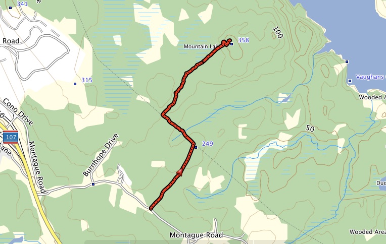
The mountain near Lake Major was named after a tragic event in 1842 where two girls wandered off and died of exposure.These little girls came to be known as the “Babes in the Woods,” and were buried at the cemetery at the Woodlawn United Church as they were found, laid together in one coffin.This hike is about 5km round trip and is moderate difficulty based on time of year. A geocache is nearby. This tracks is not an official trail but has been in usage for a number of years. You will need to park by the side of the road and wade underneath power lines until you get to the trailhead. Good boots is recommended.
Trip Summary: Melancholy Hike
Trip Stats
2.4km
Distance
1.5mi
Distance
-1h 13m
Total time
0.0km/h
Avg speed (incl. stops)
0.0km/h
Moving speed
126m
Elevation gain
83m
Elevation loss
119m
Highest point
Elevation Profile
Terrain & Pace Summary
Hilly / Technical
This route packs 126 m of climbing over 2.4 km (53 m/km) — expect frequent ups and downs and sections that demand attention.
Technical / Slow-going
Tight trails, obstacles, or frequent stops kept speeds low — come prepared.
Points of Interest near Start / End
⚠️ The businesses below were identified from public mapping data at the time of generation.
Always verify hours and ATV-friendliness before you ride.
Fuel
Irving Oil – Windsor NS
Closest fuel to ride start. Truck access, good for trailers.
View on Maps / WebRestaurant
Spitfire Arms Alehouse – Windsor NS
Local pub, ATV-friendly crowd. Check hours.
View on Maps / WebAccommodation
Clockmaker’s Inn – Windsor NS
Historic B&B in Windsor. Call ahead for ATV/trailer parking.
View on Maps / WebAccommodation
Airbnb – Hants County area
Search Airbnb for Windsor/Falmouth NS. Several rural properties welcome trailers and UTVs.
View on Maps / WebATV Community
Hants ATV Club
Local club managing many of the trails on this route. Check their Facebook page for trail conditions and gate status.
View on Maps / WebTrail Access & Pass Information
⚠️ Trail pass and gate information changes seasonally.
The notes below are based on publicly available information at time of generation — verify before you go.
- Nova Scotia Off-Highway Vehicle Act: A valid Nova Scotia OHV registration (green sticker) is required on all crown land trails. Day permits are available at some Irving / Co-op stations in Windsor.
- Kennetcook / Noel Road trail system: Parts of this loop run through managed crown land. Seasonal closures apply — typically spring break-up (late March–early May). This ride on May 2 may be on the edge of spring restrictions — confirm with Nova Scotia Crown Land Roads.
- Locked gates: Several forestry roads in this area have locked barrier gates. The Hants ATV Club Facebook page posts current gate and condition updates before weekends.
- ATV on paved roads – Windsor NS: Windsor and surrounding Hants County municipalities currently do NOT permit ATV on public paved roads. You must trailer to/from a trail head. Verify any changes with Municipality of West Hants.
- Trail passes: The provincial OHV sticker covers most crown-land trails here. Some private-land connectors may require a separate Hants ATV Club pass — check the club page before your ride.